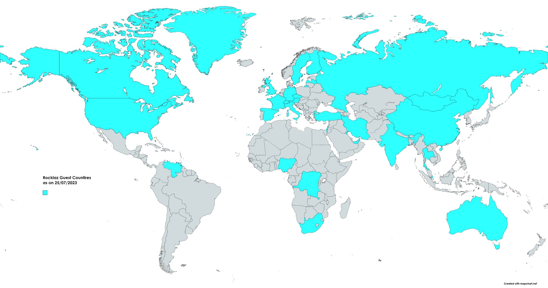
I host Rocklaz Radio podcast, I am on a mission to talk to guests of all countries. I have covered 31 countries so far. As I keep publishing new episodes, I want to update my audience on all the countries covered on Rocklaz. Currently, I am using https://www.mapchart.net/ to create the map. I colour the countries as we go ahead as you can see in the is image.
It’s cumbersome to create an image download and upload it again every time.
I want to put a map on my website, which is a cloud-based interactable map. Not just a Jpg. Basically, I want the convenience of MapChart .net but it should be integrated with my website for free.
I tried Google Maps, but the API and all that look too complicated for me.