Currently there is a small scale in the left bottom of the map screen, for general reference.
But for map visitors / users there currently seems no way to measure distance and azimith between two set points.
Would it be possible to add a measurement tool / widget to the toolbox on the left?
For example, the user clicks on the tool, then clicks on two different points on the map, and a line appears with an exact distance number (meter and feet) and a compass azimuth.
This would be immensivly usefull for hikers, divers, survivalists and other outdoorspeople, when planning trips with MapHub maps…
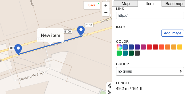
Hi Sonar - from what I’ve seen in using Maphub, you can
use the marker tool to create two points
use the line tool to connect them
*then scroll down the line item tab to see the distance - see screenshot
but I think that only works if you have editing rights, which show the tools. I guess that as map creator you could do the measurements on specific lines, and add a label with measurement (T tool).